Prediction of gravity at a given place
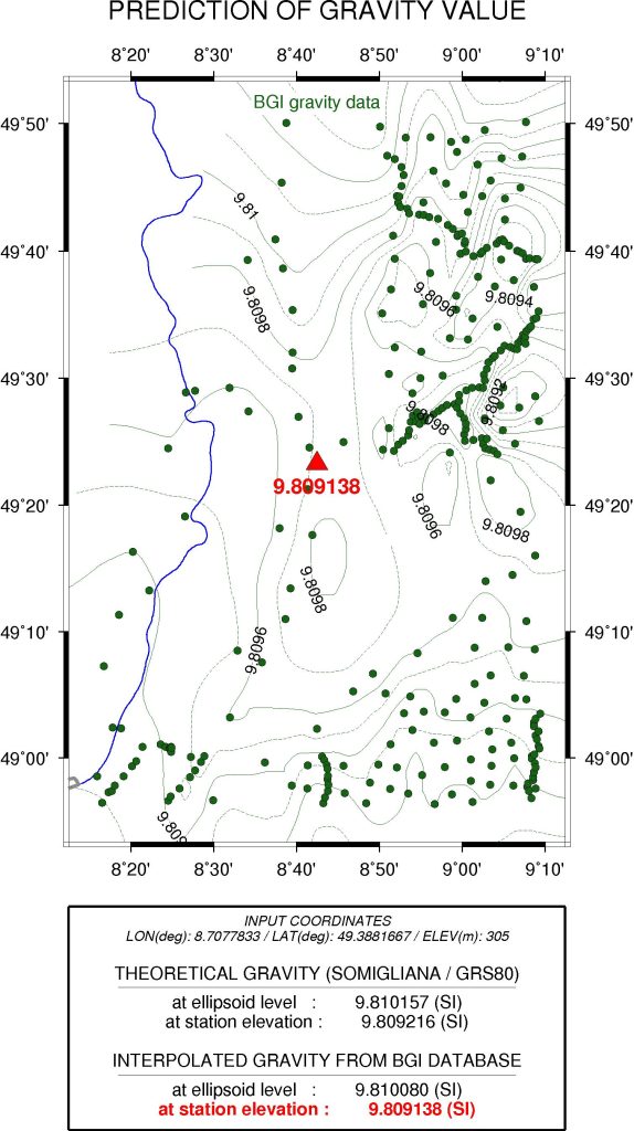
This tool allows you to estimate the gravity value at any location at the Earth’s land surface from its geographical coordinates and elevation.
The interpolated gravity is estimated from the available gravity measurements in the BGI databases.
The theorical value (normal gravity) is also computed at the same location, using the Somigliana formula in the GRS80 system.
WGM2012 derived regional gravity anomalies
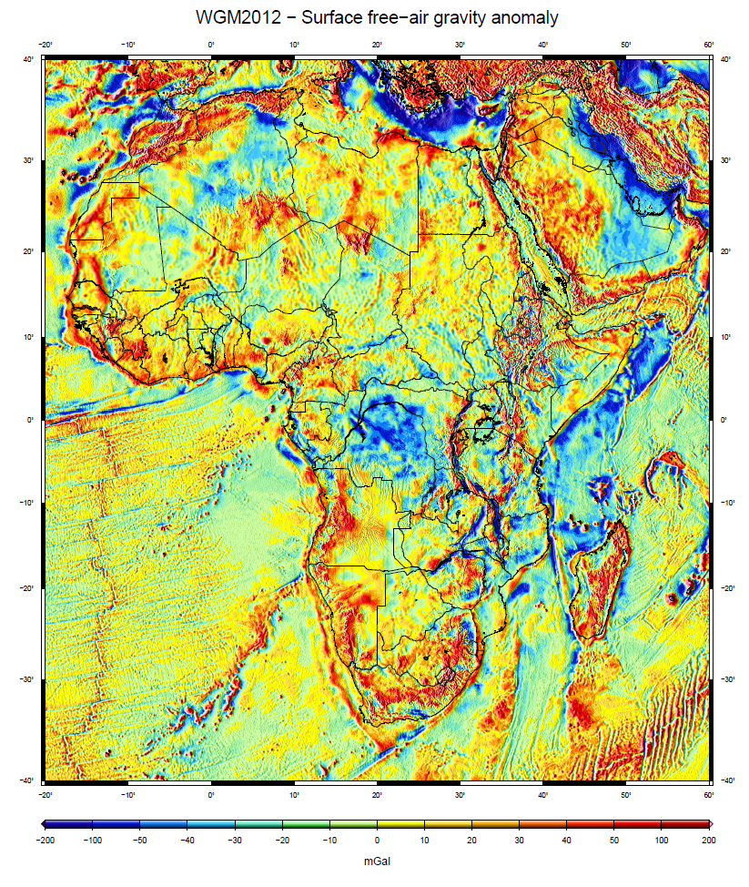
This tool allows you to view and extract regional gravity anomaly grid data from the global WGM2012 model developed by BGI for the World Gravity Map. More information…
Available grids (2’x2′ resolution)
Note : extraction limited to 100° x 100°
- Complete spherical Bouguer anomaly
- Complete spherical Isostatic anomaly (Airy-Heiskanen, Tc=30km)
- Surface free-air anomaly (Molodenski)
- ETOPO1-derived gravity disturbances of surfaces masses
- ETOPO1 topography
How to cite : Bonvalot, S., Briais, A., Kuhn, M., Peyrefitte, A., Vales, N., Biancale, R., Gabalda, G., Moreaux, G., Reinquin, F. & Sarrailh, M. (2012). Global grids : World Gravity Map (WGM2012). Bureau Gravimetrique International. https://doi.org/10.18168/bgi.23
EGM2008 derived regional gravity anomalies

This tool allows you to view and extract regional gravity anomaly grid data derived from the global EGM2008 model released by the National Geospatial Intelligence Agency (NGA). More information…
Available grids (2’x2′ resolution)
Note : extraction limited to 100° x 100°
- Complete Bouguer anomaly
- Free-air anomaly (Molodenski)